In the Edo period, travellers between Edo and Kyoto could take one of two great roads. The Tōkaidō ran mostly along the coast; the Nakasendō went inland, through the mountains of Shinano, today's Nagano Prefecture.
Along the way stood post towns, which served travellers and the transport of goods. This article looks at how the road and its post towns worked, and how some of them, such as Tsumago and Narai, came to be preserved.
One of the Five Highways
The Nakasendō was one of the Gokaidō, the five highways that formed the network of roads run by the shogunate, linking Edo with the provinces in the Edo period (1603–1868). A guide text prepared for Tsumago and published in the Japan Tourism Agency's multilingual database calls the Nakasendō and the Tōkaidō the most important of the five, because they connected Edo with Kyoto.
The same guide says that the Tōkaidō, which was fairly flat and ran mostly along the coast, saw many more travellers. The Nakasendō passed through more varied ground. Its name means "road through the mountains", which fits the roughly 80-kilometre stretch through the Kiso valley especially well.
The guide quotes the opening line of Shimazaki Tōson's historical novel Before the Dawn, which is about the upheaval the Meiji Restoration brought to the area: "The Kiso Road lies entirely in the mountains."
The road was about 530 kilometres long and on average 2.7 metres wide. Its route was not fixed: it moved up or down the mountainside after floods, landslides and the loss of bridges.
The surface was sand and earth, and local people, who provided labour in place of taxes, cleared stones and rocks from it. Because it was never used by horse carts, according to the guide, very little of it was paved.
How a post town worked
According to the Tsumago guide, Tsumago was officially made a post town in 1601, when Tokugawa Ieyasu set up the post-town system. It was the 42nd of the 69 post towns along the Nakasendō between Edo and Kyoto.
The same guide says that fewer travellers used the Nakasendō than the Tōkaidō, but that it played an important part in sankin-kōtai, the system under which daimyo lords came from their domains to Edo every other year.
The highest-ranking guests stayed at the honjin, the principal inn. A guide text for the Midono waki-honjin site, another Kiso post town, says that all eleven post towns in Kiso had both a honjin for daimyo, court nobles and shogunate officials, and a waki-honjin, a secondary inn. The waki-honjin took the overflow from the honjin and travellers of slightly lower rank.
It was also used, the text says, when the honjin could not receive guests because of an inauspicious event such as a death in the family. The honjin were built early in the Edo period, while the waki-honjin were added later as traffic on the Nakasendō increased.
In Tsumago, the Shimazaki family ran the honjin from the 16th to the 19th century, and a branch of the family ran the honjin at Magome. The novelist Shimazaki Tōson was the younger brother of the head of the Tsumago family.
The Hayashi family, who ran Tsumago's waki-honjin, did not have the honjin's stipend from the shogunate, according to the guide. To secure a steadier income they brewed sake, and they also shared the rights of the toiya, the office that supplied horses and porters to travellers.
Between the official post towns lay smaller places called ai-no-shuku, "places between". Ōtsumago, between Tsumago and Magome, is one. In eastern Shinano, Nagano Prefecture describes Motai, between the Mochizuki and Ashida post towns, as a resting place outside the post-station system that had no inns for overnight guests.
A checkpoint in the Kiso valley
The Fukushima barrier in the Kiso valley is a National Historic Site. According to the national cultural heritage database, the year it was founded is not known.
The database says that with the development of the Five Highways, Fukushima became the shogunate's gateway guarding the Kiso valley, an important barrier ranked with Hakone and Arai on the Tōkaidō and Usui on the Nakasendō. It lay roughly halfway between Kyoto and Edo, where the Kiso valley is narrowest.
Most traces of the barrier have been lost to road works, the Chūō railway line and housing. Excavations guided by a plan of about 1668 found stone rows and the foundation stones of walls, which confirmed the layout of the guardhouse and other buildings.
Eastern Shinano: from Karuizawa to Wada
The Nakasendō entered Shinano over the Usui pass. Nagano Prefecture's Saku regional office describes the eastern section, from Karuizawa to Wada, as including a crossing of the Chikuma River and the Wada pass, the highest point on the Nakasendō and a difficult section.
The prefecture says the post towns here, including Iwamurata, Mochizuki and Ashida, supported travellers and the transport of goods. It adds that the storehouse-style street of Motai has been preserved as it was.
Decline and preservation
Nagiso Town says that Tsumago's role as a post town faded with the changes in transport after the start of the Meiji period. The Tsumago guide adds a new national road opened in 1892 and a railway in 1909, and Tsumago, which no longer functioned as a post town, gradually declined.
Nagiso Town writes that preservation began at a time when the area was also losing young people to the cities during Japan's period of rapid economic growth. In 1968 the preservation of Tsumago began in earnest as a Nagano Prefecture project marking the Meiji centenary, and residents adopted a charter to protect Tsumago in 1971.
Its guiding idea, in the town's words, was that "preservation is development". On 4 September 1976 about 1,245 hectares were selected as an Important Preservation District for Groups of Traditional Buildings. The town says this is about 30 percent of the total area of all such districts in Japan.
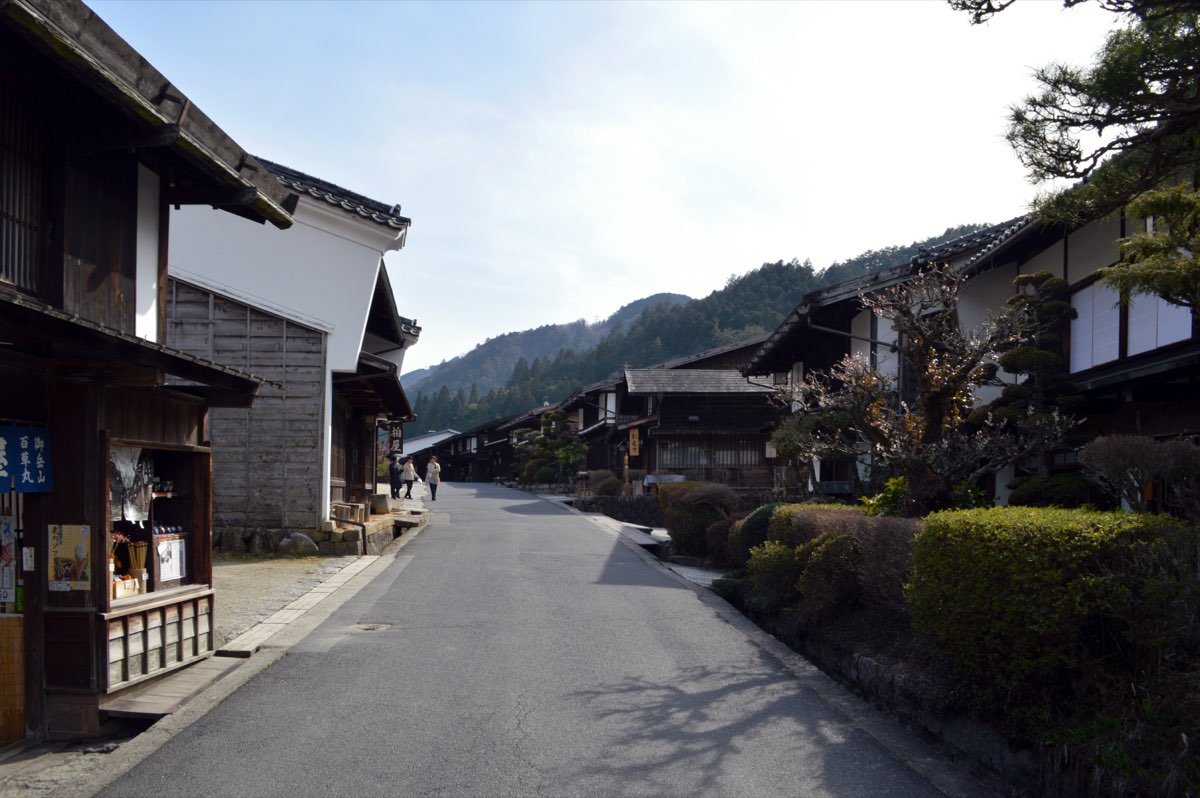
The district protects not only the buildings but also the mountain views seen from the Nakasendō. Its post-town area, lined with houses with overhanging upper floors and firewalls, keeps much of the look of the late Edo and Meiji periods.
Narai, at the foot of the Torii pass, was another busy post town. Shiojiri City says most of its townhouses stand side by side along the road, often with the upper floor jutting out over the lower.
Their deep-eaved, gently sloping roofs were once weighted with stones; now most are sheet metal. Narai was selected as a preservation district on 31 May 1978.
Also in Shiojiri City, Kiso-Hirasawa grew from the Edo period on as a town making lacquerware for daily use. According to Shiojiri City, it remains one of Japan's leading production areas, with lacquerware shops along the Nakasendō, and it was selected as a preservation district in 2006.
Visiting the post towns today
In Tsumago, the honjin building was reconstructed in 1995, based on a late Edo-period floor plan and on the plans of several other honjin, which are displayed inside. The Hayashi family's waki-honjin, known as Okuya, has been open to the public since 1967; it came to its present site when it was last rebuilt, in 1877.
In 2016 the Kiso area, including Tsumago, was recognised as Japan Heritage. Nagiso Town notes that since 2023 many visitors from abroad have come to Tsumago (as of May 2026).
In Narai and Kiso-Hirasawa, the preservation societies make hand-drawn maps showing what to see in each district and hand them out free to visitors (as of April 2026). In eastern Shinano, the prefecture points readers to the official Higashi-Shinshū Nakasendō website for access to Motai and the other post towns.
Opening times and fees for the honjin and other buildings can change, so check the official websites of the towns and museums before you visit.
Sources
- 中山道Nagano Prefecture
- 国史跡 中山道 中山道(地域観光資源の多言語解説文データベース)Tsumago-juku liaison council (妻籠宿連絡調整会議; text in the Japan Tourism Agency multilingual database)
- 妻籠(地域観光資源の多言語解説文データベース)Japan Tourism Agency multilingual database (regional text for Tsumago)
- 妻籠宿本陣(地域観光資源の多言語解説文データベース)Japan Tourism Agency multilingual database (regional text for Tsumago)
- 妻籠の脇本陣(地域観光資源の多言語解説文データベース)Japan Tourism Agency multilingual database (regional text for Tsumago)
- 国史跡 中山道 三留野宿脇本陣(地域観光資源の多言語解説文データベース)Tsumago-juku liaison council (妻籠宿連絡調整会議; text in the Japan Tourism Agency multilingual database)
- 国史跡 中山道 大妻籠(地域観光資源の多言語解説文データベース)Tsumago-juku liaison council (妻籠宿連絡調整会議; text in the Japan Tourism Agency multilingual database)
- 南木曽町妻籠宿(長野県) 伝統的建造物群保存地区の概要Agency for Cultural Affairs (document prepared by Nagiso Town)
- 塩尻市奈良井・木曾平沢(長野県) 伝統的建造物群保存地区の概要Agency for Cultural Affairs (document prepared by Shiojiri City)
- 福島関跡(文化遺産オンライン)Agency for Cultural Affairs (文化遺産オンライン, national designated cultural properties data)